
Corona ZIP Code Coverage
Corona’s postal geography has seven entries in the city GIS layer: 92503, 92878, 92879, 92880, 92881, 92882, and 92883. The Citrus post-office designation, 92877, has no Census ZCTA polygon but still matters when USPS assigns it to a delivery or post-office box. The practical lookup table therefore includes eight mailing entries while keeping the GIS distinction clear. A ZIP code is a delivery construct, not a promise that the address sits inside incorporated Corona.
| ZIP | Areas Covered | Post Office | Notes |
|---|---|---|---|
| 92503 | Tiny eastern Corona city edge, mostly Riverside geography | Riverside-area postal service | Only an edge overlap in the official city ZIP/ZCTA layer |
| 92877 | Corona and Citrus postal designation | Citrus, 1941 California Avenue | No Census ZCTA polygon; confirm delivery use with USPS |
| 92878 | North-central and northwest Corona | Corona Main, 414 W. Grand Boulevard | Expanded to delivery use in 2020 after a 92880 change |
| 92879 | North and east-central Corona | Corona postal service | Near Riverside and Norco-facing edges |
| 92880 | West and northwest Corona | Corona postal service | Growth and county-edge area; verify parcel by parcel |
| 92881 | South and east Corona | Corona postal service | Newer areas need a jurisdiction check |
| 92882 | Central, west and southwest Corona | Corona postal service | City Hall and many civic addresses use this ZIP |
| 92883 | Far south Corona and Temescal Valley mailing geography | Corona postal designation and service | Many mailing addresses sit outside incorporated Corona |
The table separates a postal service point from a geographic polygon. ZIP 92877 is the clearest example: Citrus supplies the post-office designation, but the absence of a Census polygon means it should not be treated as a clean map area. ZIP 92883 is the larger jurisdiction trap, because a Corona mailing label can reach unincorporated Temescal Valley. USPS confirms delivery; city GIS confirms jurisdiction.
The Corona Main Post Office location record lists 414 W. Grand Boulevard, ZIP 92878, phone 951-737-3120, weekday retail hours of 8:30 a.m. to 5:30 p.m., and Saturday retail hours of 9 a.m. to 3 p.m.
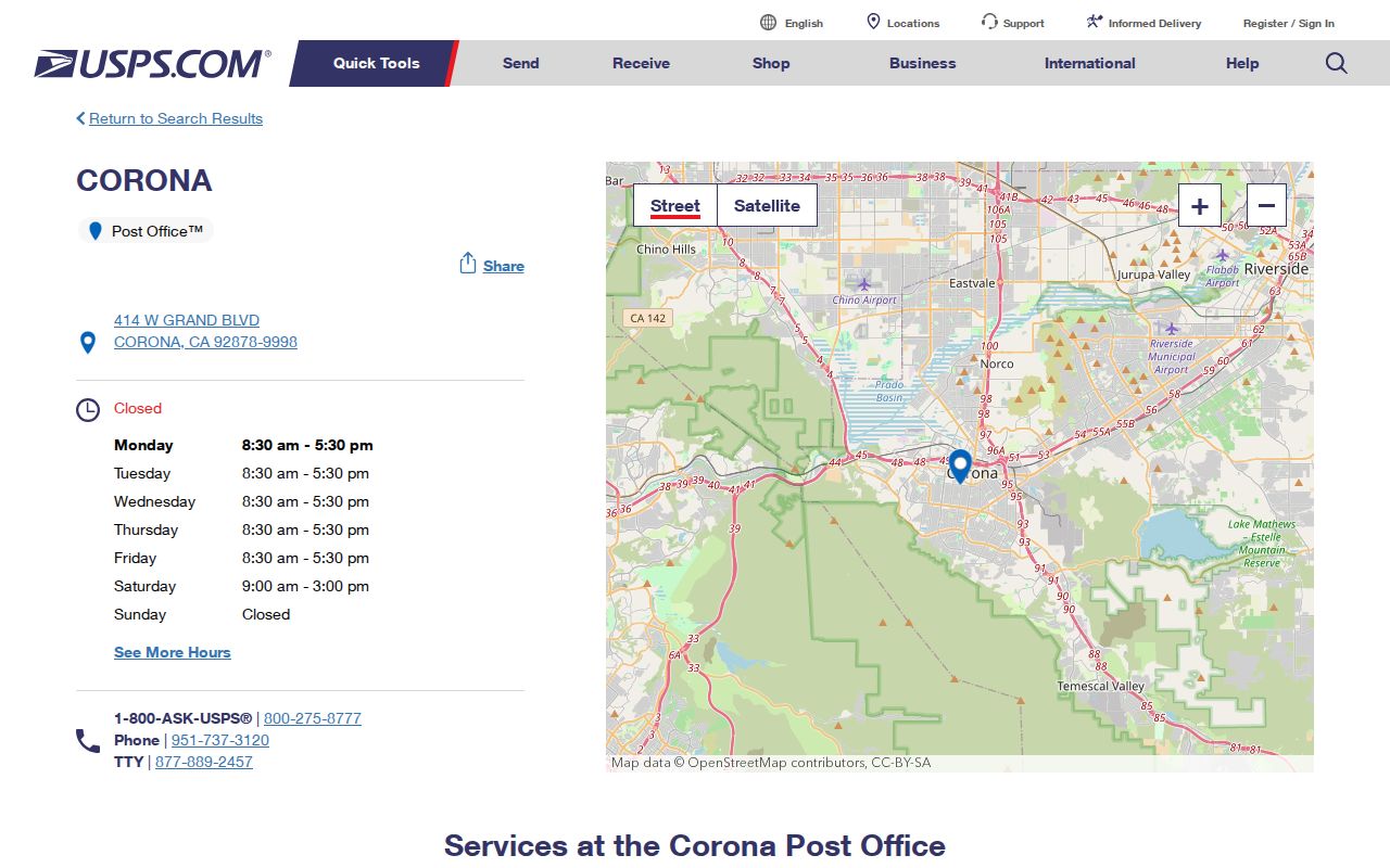
The Main Post Office record is useful for checking a postal service point, not for deciding which parcels belong to the incorporated city.
The Citrus Post Office location record lists 1941 California Avenue, ZIP 92877, phone 951-340-3783, the same weekday and Saturday retail hours, plus 24-hour post-office-box and kiosk access.
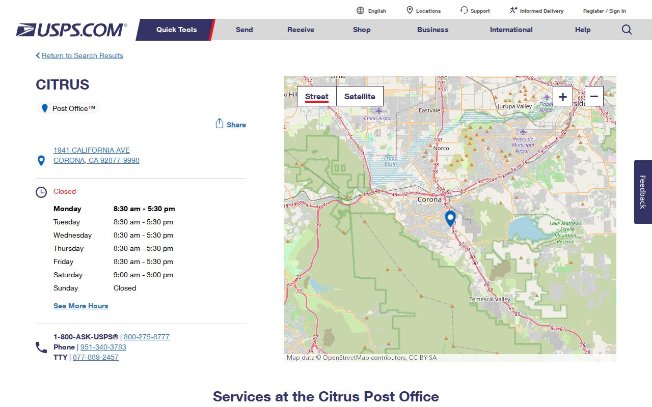
Citrus explains why a postal name can sit beside, rather than inside, a city boundary. Confirm the individual address before using the ZIP as a local-record clue.
Corona Temescal Valley Boundary
ZIP 92883 carries a Corona postal label across far-south Corona and Temescal Valley mailing geography. The label can cross the incorporated-city line, so a city request should not be sent only because a letter says Corona. Use the address in the county and city GIS systems, then identify the actual jurisdiction before asking for planning, permit, police, or other municipal records.
The Corona ZIP and ZCTA GIS layer displays 2020 Census ZCTAs and the locally added 92878 entry. It is a boundary aid, not a resident roll. A parcel search can show the city line and property identity, while USPS remains the authority for the delivery ZIP.
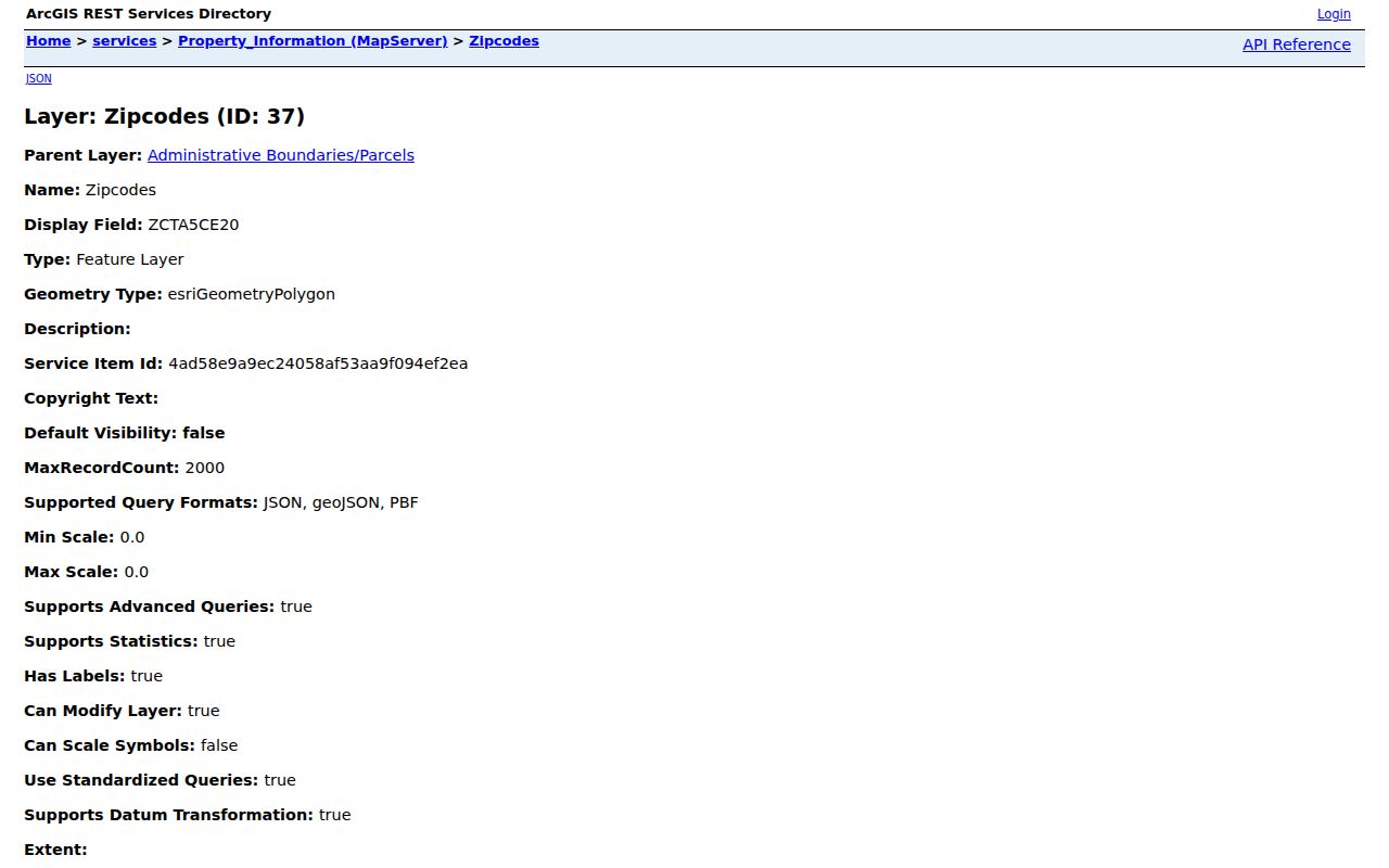
The GIS layer makes the postal-versus-municipal split visible. A 92883 address still needs a parcel-level jurisdiction check before it is treated as a Corona city record.
Boundary check. A Corona ZIP identifies mail routing; the incorporated city line identifies which public office holds a local record. Check both before relying on a ZIP match.
Verify a Corona ZIP Code
USPS answers the delivery question, while GIS answers the jurisdiction question. The USPS ZIP lookup can list ZIPs associated with a city and state, or confirm the ZIP assigned to one street address. That distinction matters for a Corona ZIP-by-ZIP search: a city-and-state result is a broad postal list, while an address result tests one delivery point.
| City and state | Enter Corona and California to see the ZIP codes USPS associates with that mailing place. |
|---|---|
| One address | Enter the full delivery address to confirm the assigned ZIP for that point. |
| City GIS | Compare the address or parcel with the incorporated boundary and local ZIP/ZCTA layer. |
| County parcel | Use APN or street address when a public-record search needs a property key rather than a ZIP. |
These fields do not create a ZIP-wide list of people. They set the place and the record custodian. If the address is in unincorporated Riverside County, a Corona postal label cannot transfer the request to Corona City Hall.
The USPS lookup screen is the right first check when an older deed, directory, or family note uses a different ZIP from a current address.
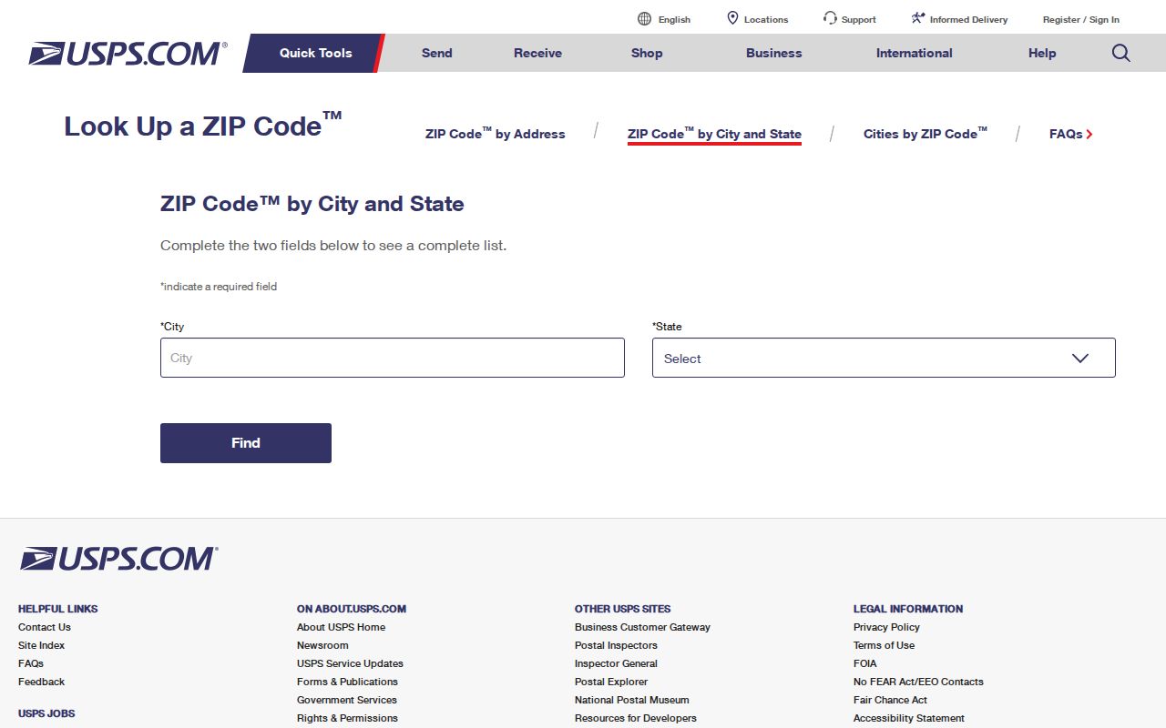
USPS lookup confirms the mailing assignment; the parcel and city layers still decide how a resident record should be pursued.
Finding Corona Residents by ZIP Code
A ZIP can narrow a resident lookup, but Riverside County’s strongest public property path is an address or APN search. The ACR Property Search returns parcel information from a street address, APN, or assessment/PIN. The online card does not display the owner name under the county’s current policy, so a ZIP alone is not a name list. Map My County can show parcels and layers, but its map is informational and not certified.
- Confirm the delivery ZIP with USPS for the exact address. Record the street spelling, direction, and unit details before using a public index.
- Check the Riverside Map My County viewer or Corona ZIP layer. Select the parcel, save the APN and situs, and test the city boundary.
- Run the ACR property search by street, APN, or assessment/PIN. Move to the recorder index with the owner or party name only when the official parcel path supplies one.
- For voter data, use My Voter Status only for an identity-matched self-check. A file by ZIP or other geographic scope requires a qualified-purpose application and registrar review, not casual browsing.
Once a ZIP has been reduced to a known street, the Corona street directory workflow can take over with parcel, deed, and address-keyed records. Keep the ZIP as a filter, not as proof that every person at that postal label belongs to one city or one household.
Corona's Northern Postal Edge
ZIP 92879 reaches north and east-central Corona near Riverside and Norco-facing edges. ZIP 92880 serves a broad west and northwest growth area near county and city edges. Both are useful postal filters, yet neither one removes the need for an address and parcel check. A family note, directory entry, or recorded document may retain an older ZIP, so compare the date of the source with the current USPS assignment.
The sharpest change is the 2020 move from 92880 to 92878. USPS Postal Bulletin 22550 records that 7,765 deliveries formerly using Corona 92880 were directed to use 92878 beginning July 11, 2020. An older address record can therefore look wrong while still describing the same delivery geography. Test the address, not just the printed ZIP.
The USPS Postal Bulletin notice is the dated source for that ZIP change.
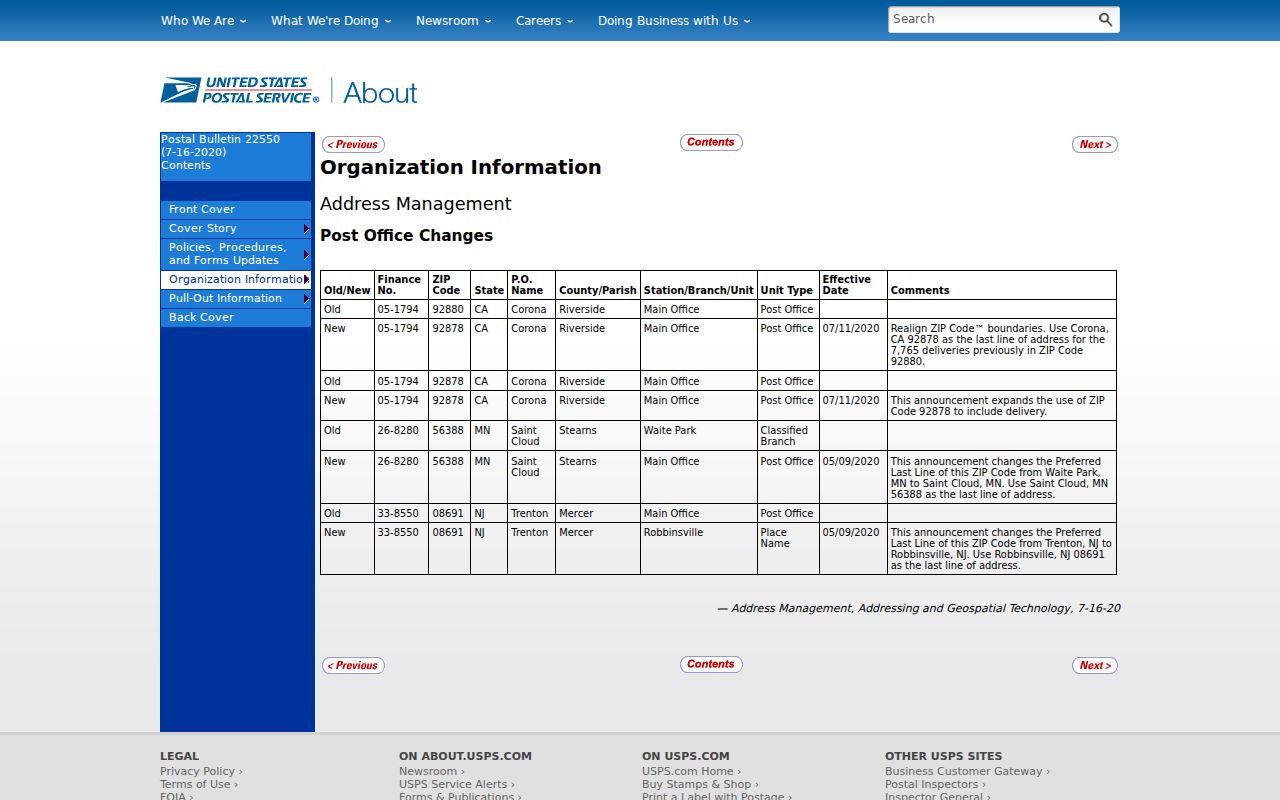
The bulletin supplies the historical explanation for a 92880 or 92878 mismatch. It does not change the legal identity of a parcel or the city that holds a local record.
Corona's South and Central Areas
ZIP 92881 covers south and east Corona, including newer areas where subdivision growth can make a street label less useful than an APN. ZIP 92882 covers central, west, and southwest Corona. City Hall and many civic addresses use 92882, but a civic mailing label still does not define every city edge. Parcel geometry and the actual jurisdiction control a property, planning, permit, or public-record request.
For a person tied to an older central address, compare the ZIP with directories, newspaper dates, and the deed or assessment record. For newer south or west areas, subdivision maps, permits, assessments, and digital GIS may be stronger place clues. A postal list can point to the right area, but the record type decides which office can confirm the connection.
Use APNs When ZIPs Change
Property records use more than one address identity. Situs is where the land sits. Mailing address is where the tax notice goes. The legal description names the land through a subdivision, lot, map, or metes-and-bounds description. An APN is the assessor’s parcel key. The ZIP label is a mail-routing field. These fields can disagree without any one of them being a typo.
- ZIP code
- A five-digit USPS delivery area label. It follows postal routing and may cross a city line.
- ZIP+4
- The five-digit ZIP plus four digits that refine delivery to a segment, building, or group of addresses.
- PO-box ZIP
- A postal designation tied to box service or a post office rather than a broad geographic Census area.
- ZCTA
- A Census approximation of ZIP geography. It is not the same thing as a USPS delivery boundary.
- Carrier route
- A postal delivery path within a ZIP, useful for mail operations but not a city jurisdiction or resident roll.
When a street name, ZIP, or address number shifts, APN and legal description are steadier links to a parcel. Use them to connect an old record to the current map, then separate ownership from occupancy and the tax-mail contact from the person who lives at the situs.
Corona ZIP Codes Versus City Limits
Postal geography and municipal geography answer different questions. A Corona ZIP may extend into unincorporated Riverside County, while a city parcel may carry a postal label associated with a neighboring service area. The mismatch is most visible in 92883 and in the 92877 Citrus designation. It also appears when records span the 92880 to 92878 delivery change.
Before a ZIP-based resident lookup, confirm the exact address with USPS, confirm the parcel and incorporated status in GIS, and send the request to the custodian that actually holds the record. Riverside County ACR handles deeds, assessments, marriages, fictitious business names, and many vital copies. Corona City Clerk handles city records. Riverside Superior Court handles court files. The postal label does not reassign those custodians.
Mismatch warning. A ZIP-wide search can mix incorporated Corona, neighboring communities, and unincorporated areas. Use a street, APN, legal description, or verified jurisdiction before treating a match as local.
That final check keeps Corona postal research useful without turning mail geography into a claim about a person, a parcel, or a city boundary.